Anna Koch · 12 October 2026
Community Workshops Highlight Connections Between Salinity Readings, Quay Integrity, and Aquatic Species Responses
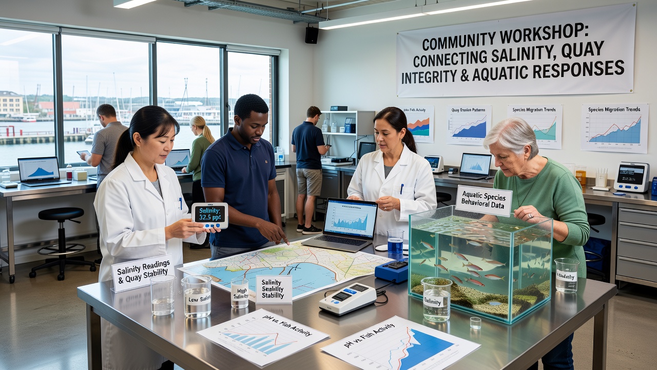
Community workshops across several coastal regions have brought together local residents, marine biologists, and engineers to examine how salinity measurements relate to the structural condition of quays and the behavior of aquatic species in nearby waters. These gatherings focus on data collected from harbor sensors that track salt levels alongside regular inspections of dock pilings and bulkheads, while also recording shifts in fish populations and invertebrate activity. Organizers designed the sessions to show participants how changes in one element often influence the others in measurable ways.
Salinity Data as a Starting Point
Salinity readings provide a foundation for understanding harbor conditions because salt concentrations affect both metal and concrete components of quays and the physiological tolerances of many marine organisms. Workshop facilitators presented time-series graphs from monitoring stations that showed seasonal spikes in salinity during dry periods, followed by drops after heavy rainfall. Participants reviewed how prolonged high salinity accelerates corrosion on steel pilings and weakens concrete surfaces through chemical reactions, while lower salinity periods coincide with increased sightings of certain estuarine fish species that prefer brackish conditions.
Engineers at the sessions explained that quay integrity assessments now incorporate salinity trends because repeated exposure to fluctuating salt levels speeds up material fatigue. One case study from a monitored harbor revealed that sections of quay exposed to consistent salinity above 30 parts per thousand required earlier maintenance interventions than areas with greater seasonal variation. At the same time, biologists shared records indicating that species such as juvenile flatfish and certain crab populations moved into shallower waters during lower salinity events, altering local food web dynamics.
Linking Structural Health to Habitat Changes
Quay integrity surveys conducted alongside biological sampling demonstrate direct connections between dock condition and species distribution. When concrete surfaces develop cracks from salt-induced expansion, those fissures create microhabitats that shelter small crustaceans and algae, which in turn attract foraging fish. Workshop attendees examined underwater photographs showing higher densities of gobies and blennies near deteriorated quay sections compared with smooth, intact surfaces. Data logs from acoustic tags further illustrated that some migratory species altered their passage routes when salinity gradients near quays shifted abruptly.

Researchers noted that these patterns emerge most clearly when salinity data, structural inspection reports, and species counts are analyzed together rather than in isolation. A joint presentation at one workshop displayed overlaid maps where areas of moderate quay degradation aligned with peak abundance of filter-feeding organisms, while heavily corroded zones showed reduced diversity. Such correlations help port authorities schedule repairs during windows that minimize disruption to sensitive life stages of local marine life.
October 2026 Workshop Series Expands Scope
Plans for an expanded series of community workshops in October 2026 aim to incorporate additional sensor arrays and citizen science contributions. Organizers expect participants to analyze extended datasets that cover multiple tidal cycles and include temperature cross-references. Sessions will feature live demonstrations of how salinity probes are calibrated and how divers document surface condition changes on quay faces. Early registration figures indicate strong interest from schools and fishing associations, suggesting broader community involvement in tracking these interconnected variables.
Similar efforts in other regions have produced comparable insights. Data compiled by the National Oceanic and Atmospheric Administration shows that harbors with integrated monitoring programs record faster identification of areas where salinity-driven structural wear coincides with species range shifts. In parallel, reports from the European Environment Agency document how coordinated observation networks along the North Sea coast have improved predictive models for both infrastructure lifespan and ecological responses.
Practical Outcomes from Combined Monitoring
Workshop participants have begun applying the combined approach in their own local contexts. Several harbor management teams now schedule annual quay inspections to coincide with peak salinity monitoring periods, allowing simultaneous collection of structural and biological samples. This timing reduces vessel traffic interruptions and provides comparable datasets across years. One harbor authority adjusted its maintenance calendar after workshop discussions revealed that certain fish spawning periods overlapped with optimal repair windows under lower salinity conditions.
Training materials distributed at the events include protocols for recording salinity at fixed depths, photographing specific quay features, and noting species presence during standardized observation windows. These standardized methods enable comparison across sites and support larger-scale analysis by research institutions. Follow-up sessions scheduled after the initial workshops will review new data uploads and refine the shared database.
Conclusion
The community workshops continue to demonstrate that salinity readings, quay integrity metrics, and aquatic species responses form an interconnected system best understood through simultaneous observation. By presenting data from multiple disciplines in accessible formats, the sessions equip participants with tools to interpret local conditions and contribute to ongoing monitoring efforts. Future gatherings planned for October 2026 will build on these foundations, incorporating additional variables and expanding the geographic reach of the collaborative network.